Campound maps national parks, forests, BLM land and wilderness — with live campground availability, trails and forest roads, and turn-by-turn nav that knows the off-road network. And it works with no signal.
From land ownership to open campsites to elevation — every part of the trip, in your hand.
Plan it at home on Wi-Fi. Live it in the backcountry with no bars. Campound is built for both.
One app, one map, one dictionary of pin types. The features below overlap on purpose.
Or read the guide for hikers & mountain bikers, overlanders, or campground campers
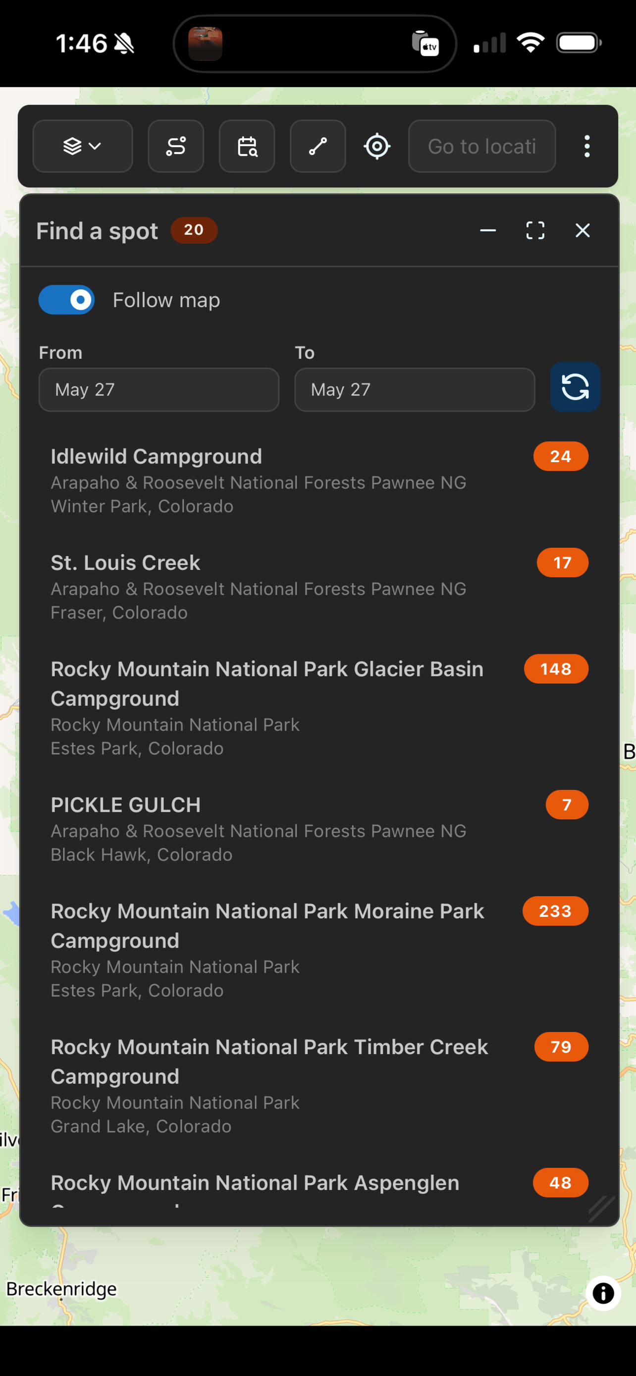
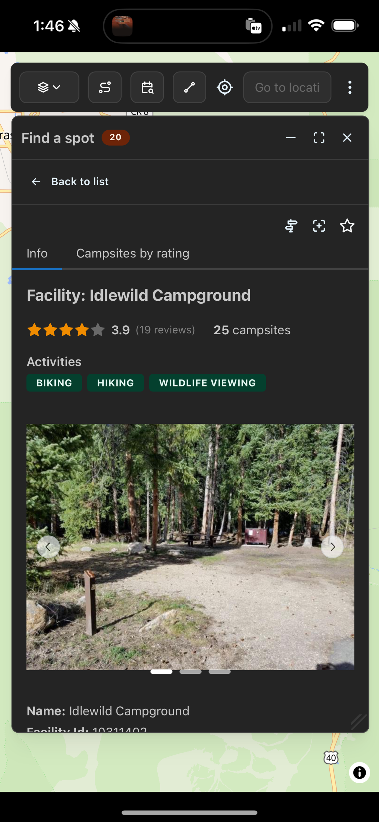
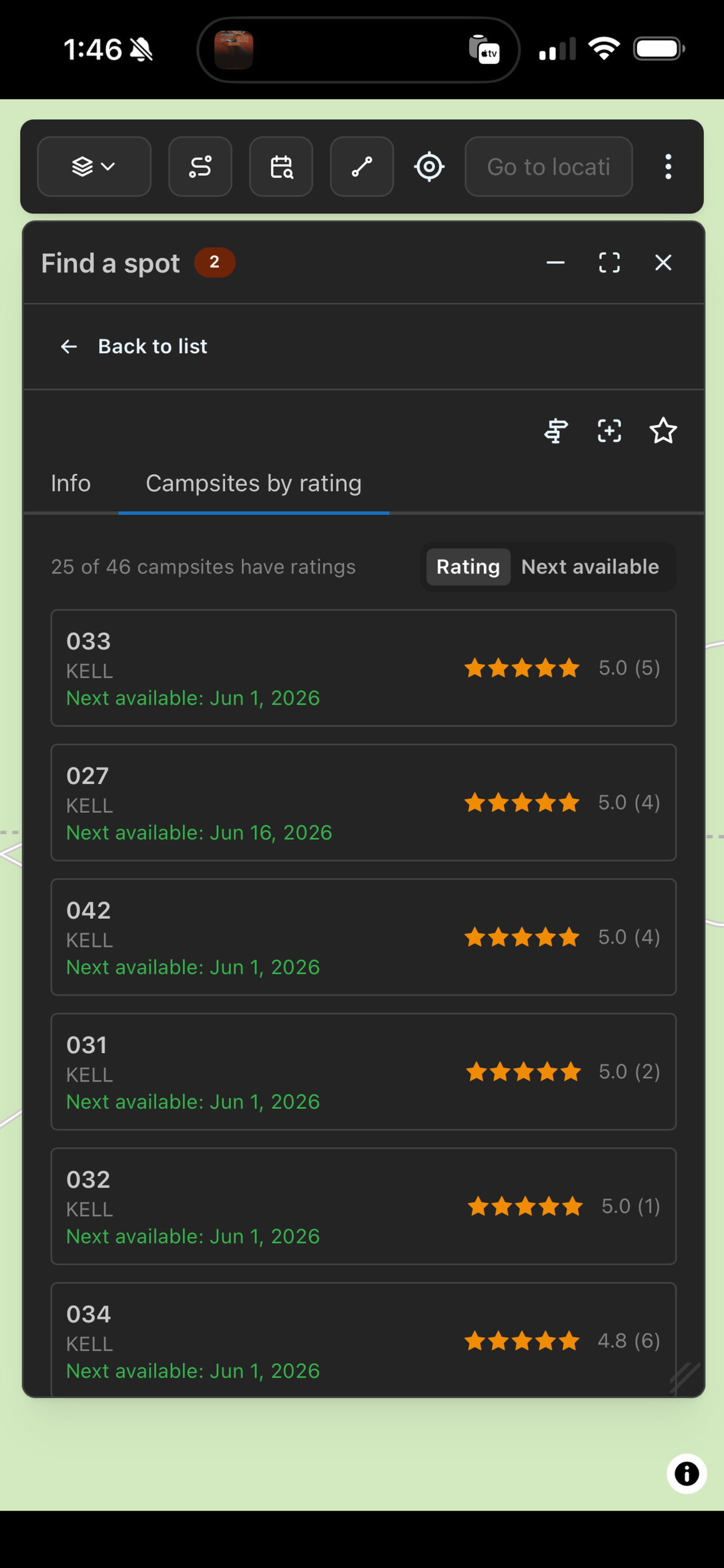
Search reservable campgrounds by date range and see live availability from Recreation.gov — open nights, not just listings. Open any site for ratings, reviews and an availability calendar.
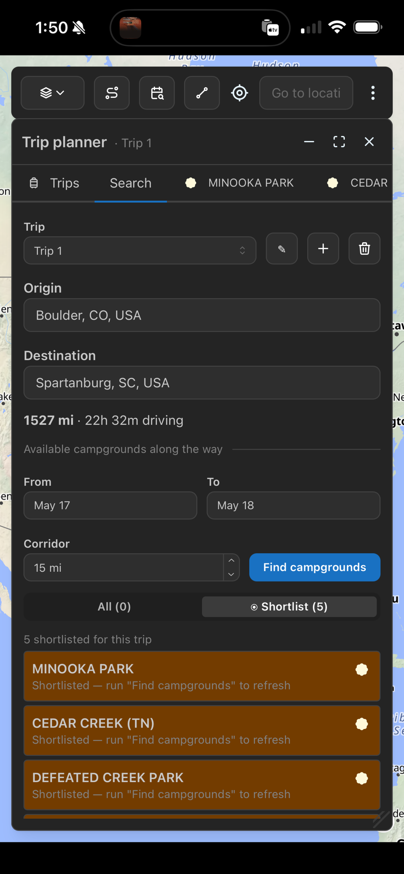
Read the guide →Stitch together campgrounds, trails, forest roads, and your own places and routes into one trip. Drop in a driving route to find campgrounds along the corridor with live availability — or skip the pavement and plan a fully off-piste itinerary.
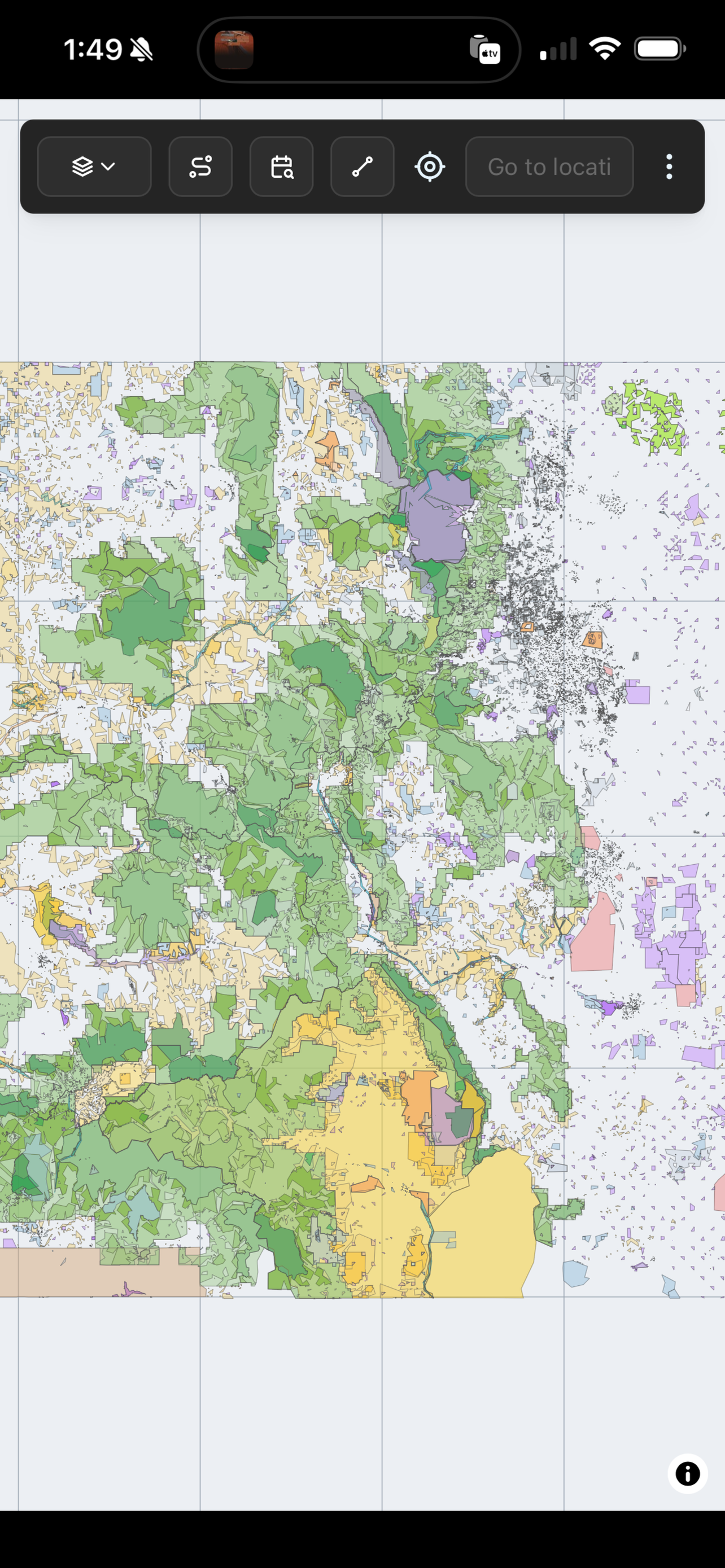
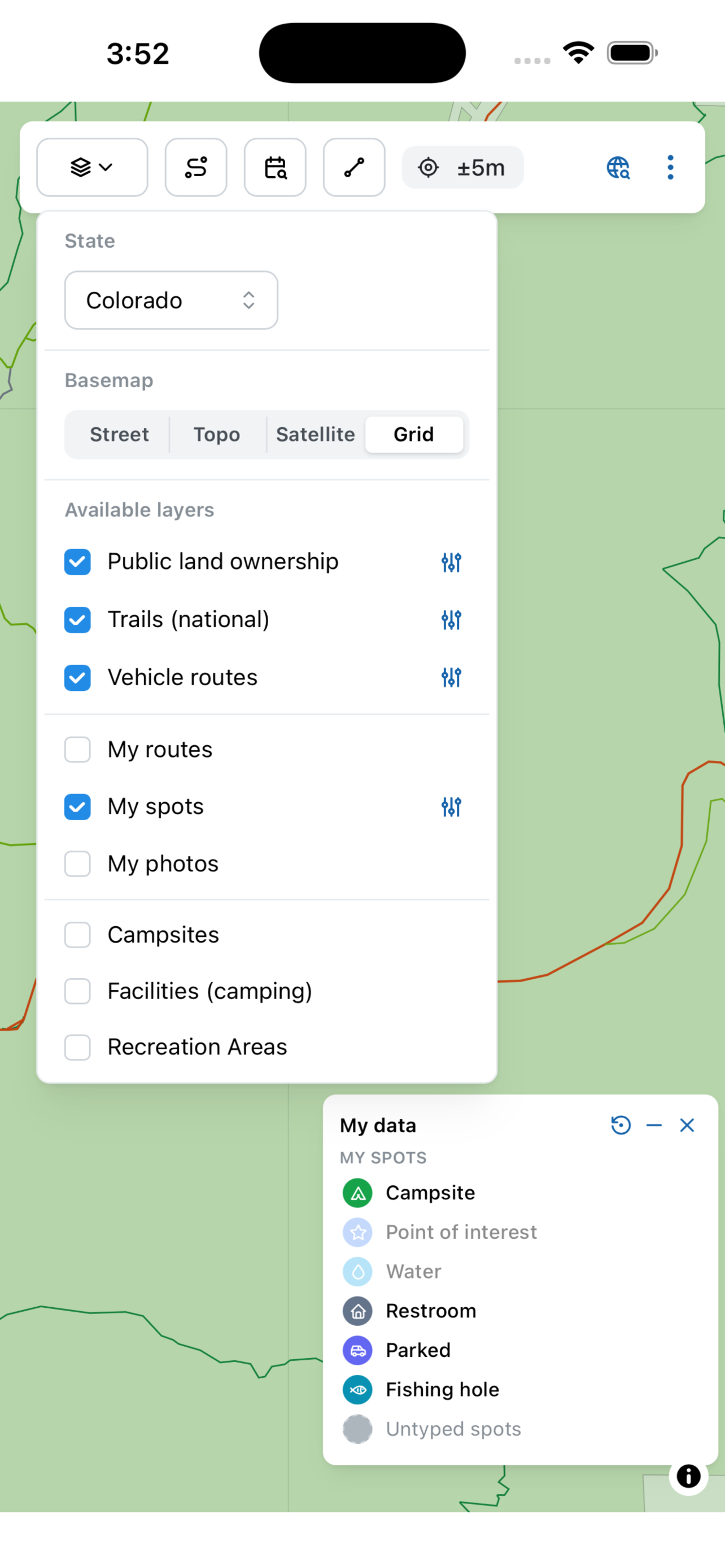
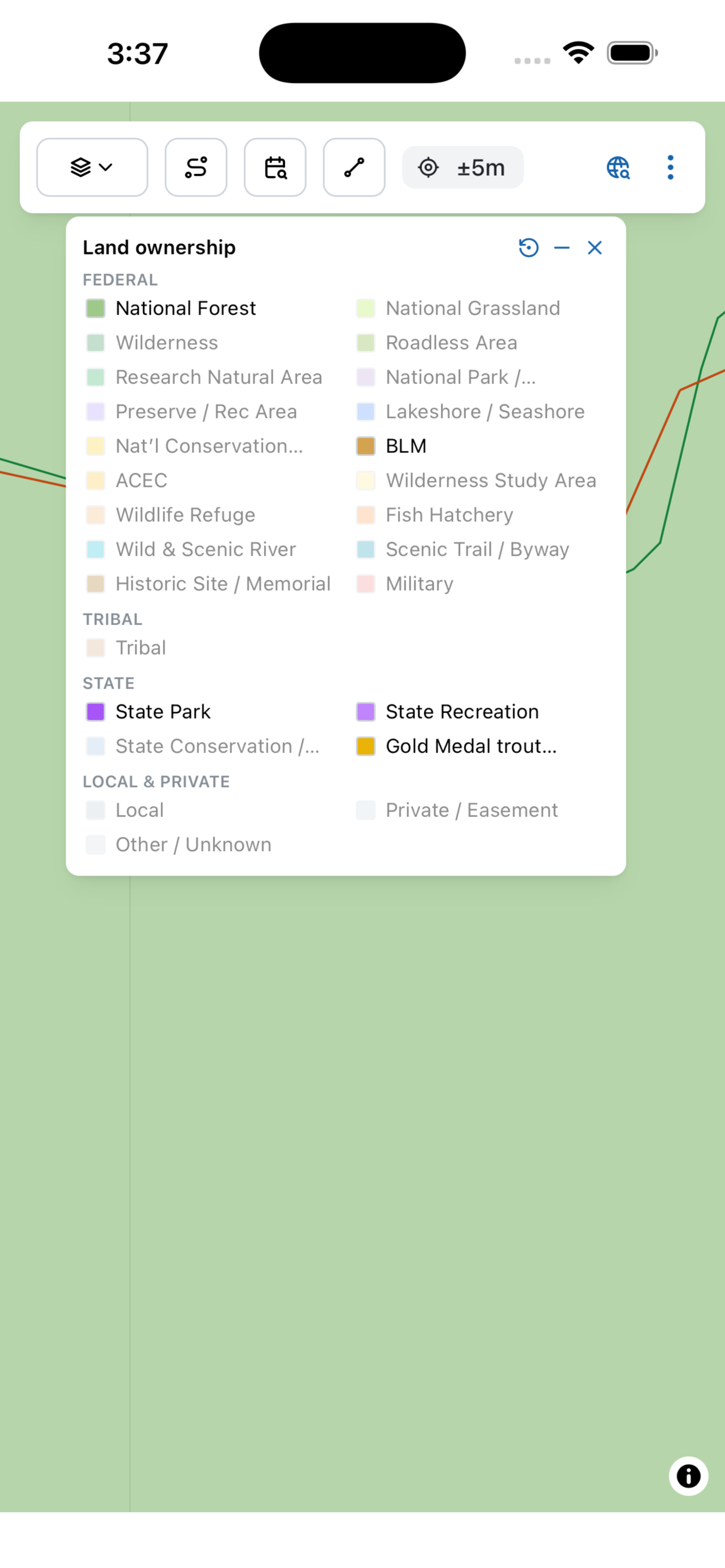
Read the guide →PAD-US ownership color-coded by type — parks, forests, BLM, wilderness, monuments, and state, local, tribal and private land — with a toggleable legend so you always know whose rules apply.
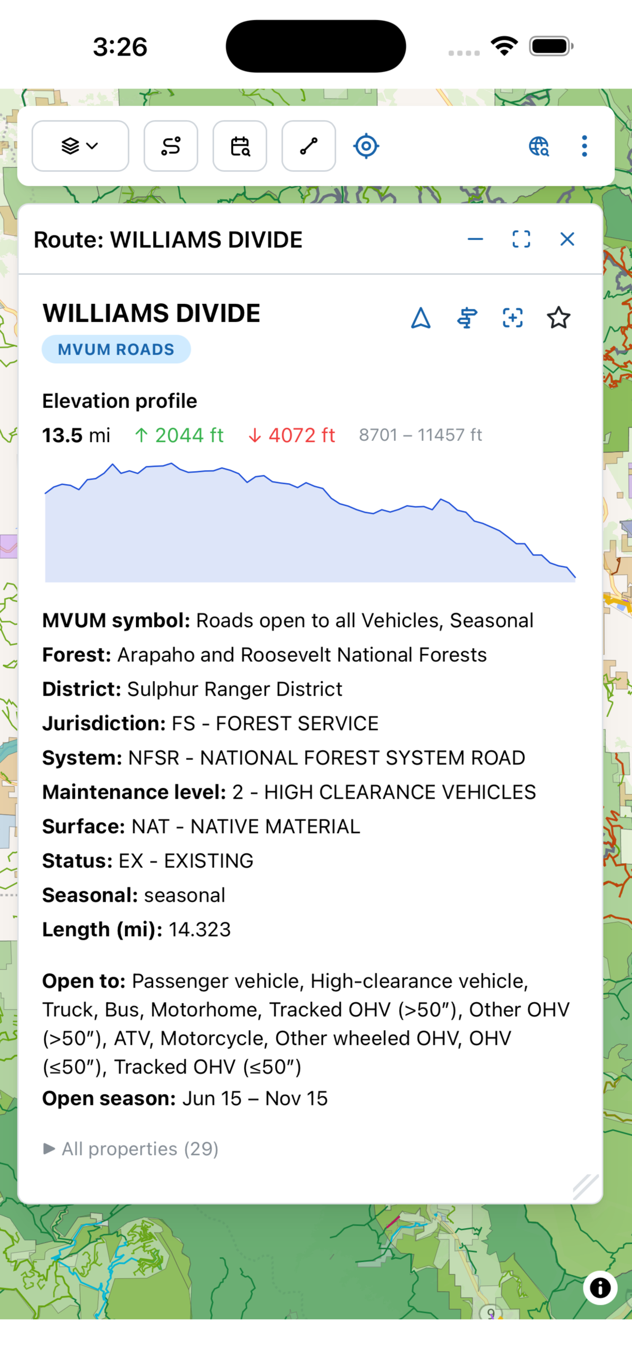
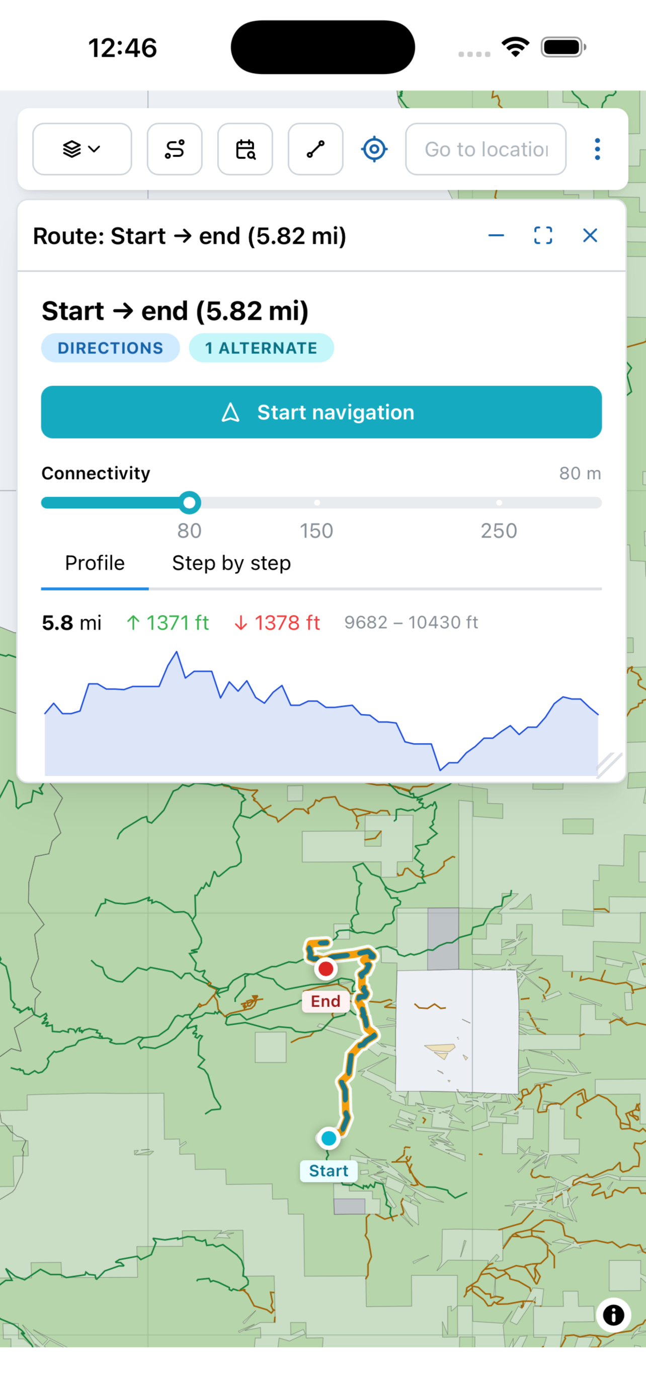
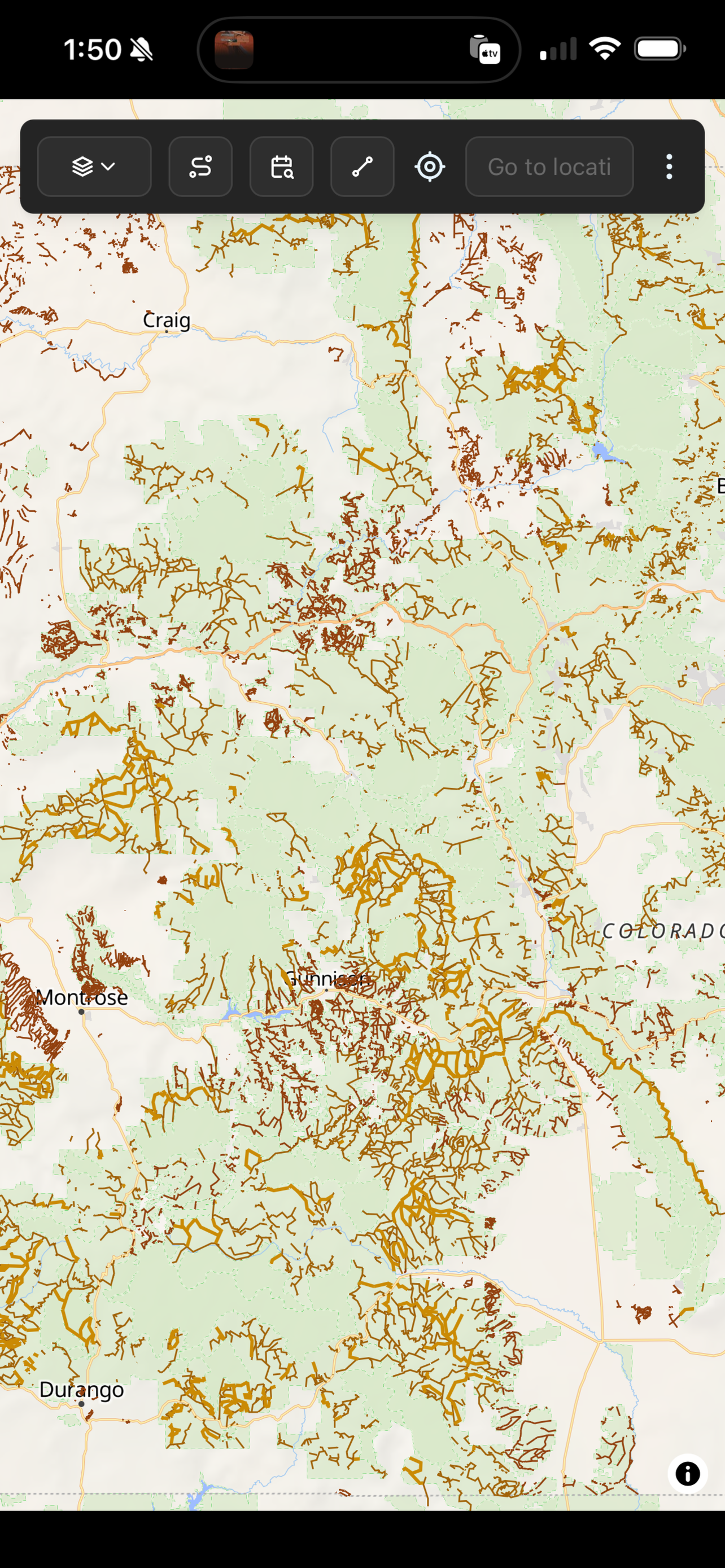
Read the guide →Tappable National Forest trails, Forest Service roads, OHV and BLM routes — each layer carries the publisher's full metadata (per-vehicle-class permissions, season ranges, surface, OHV designation, special-designation tags). MVUM symbol codes are decoded inline, so "9" reads as "Trails open to motorcycles, Yearlong" without a USFS data dictionary in hand. Open any route for an elevation profile with gain, loss and distance.
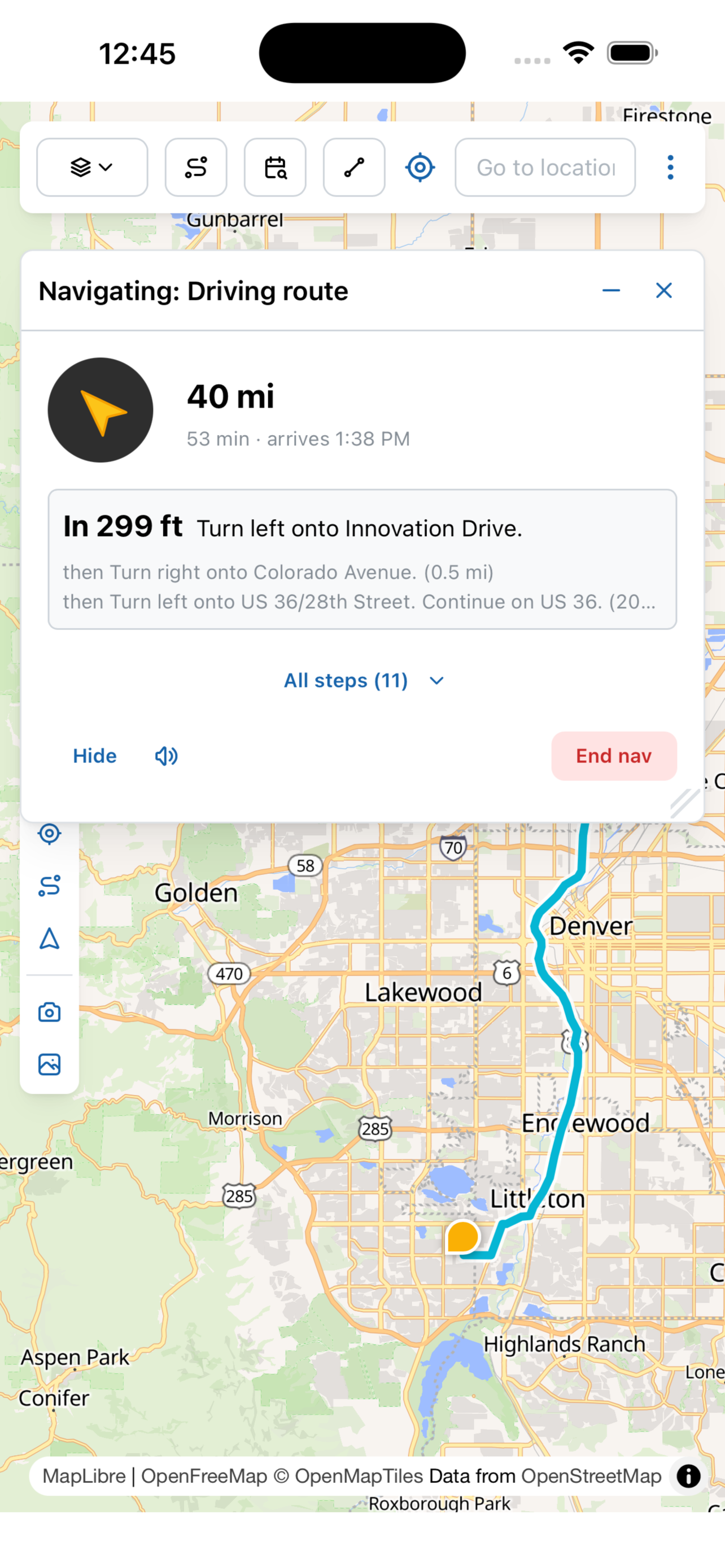
Read the guide →Drive to any campground, trailhead or saved point with voice, ETA and drift-recalc. The router is hybrid: Mapbox handles the paved portion, then Campound's own router takes over across Forest Service, BLM and OHV roads — the off-road portion runs on the bundled tiles, so it keeps going when signal doesn't. The point-to-point directions tool also routes along hiking trails, with a Mixed / Roads / Trails toggle so you can rerun the same start/end on a narrower layer set.
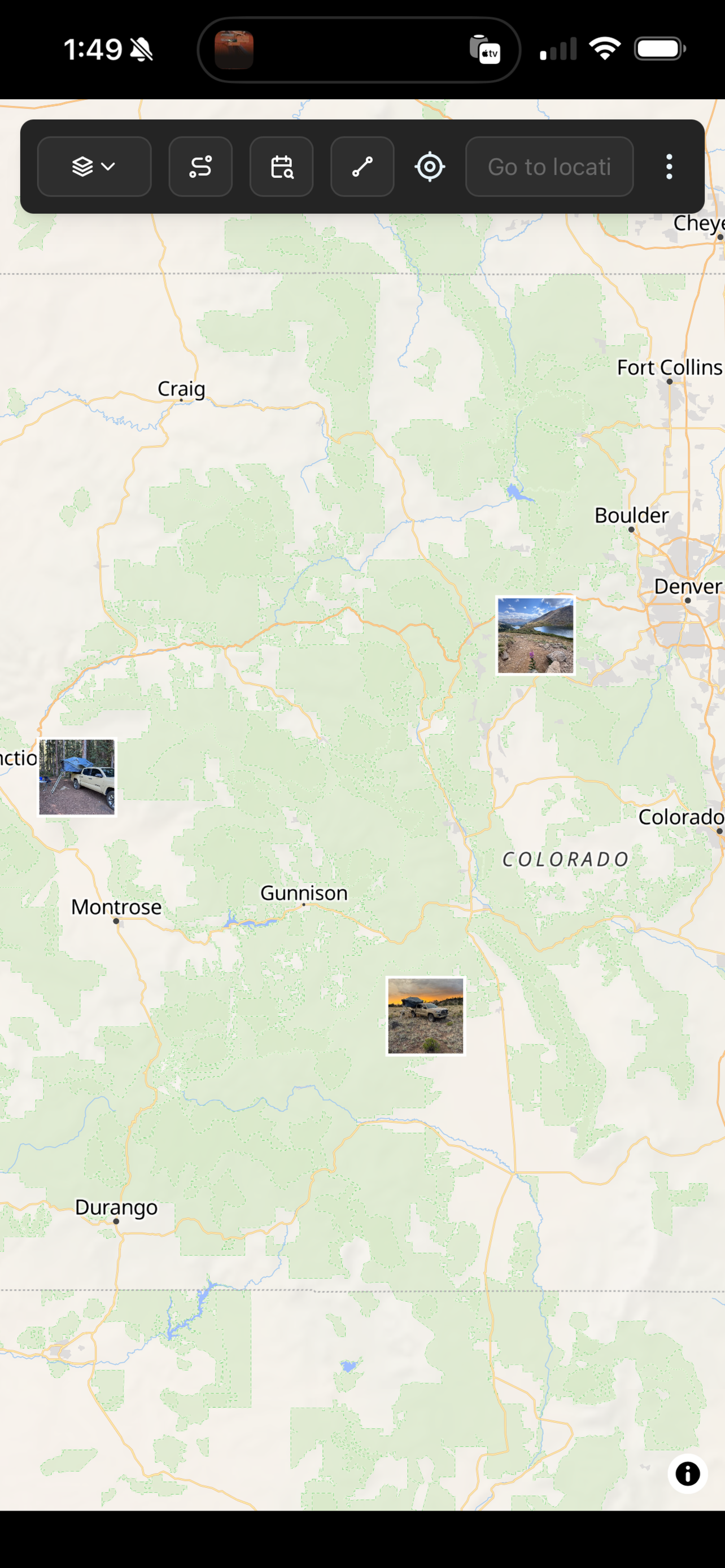
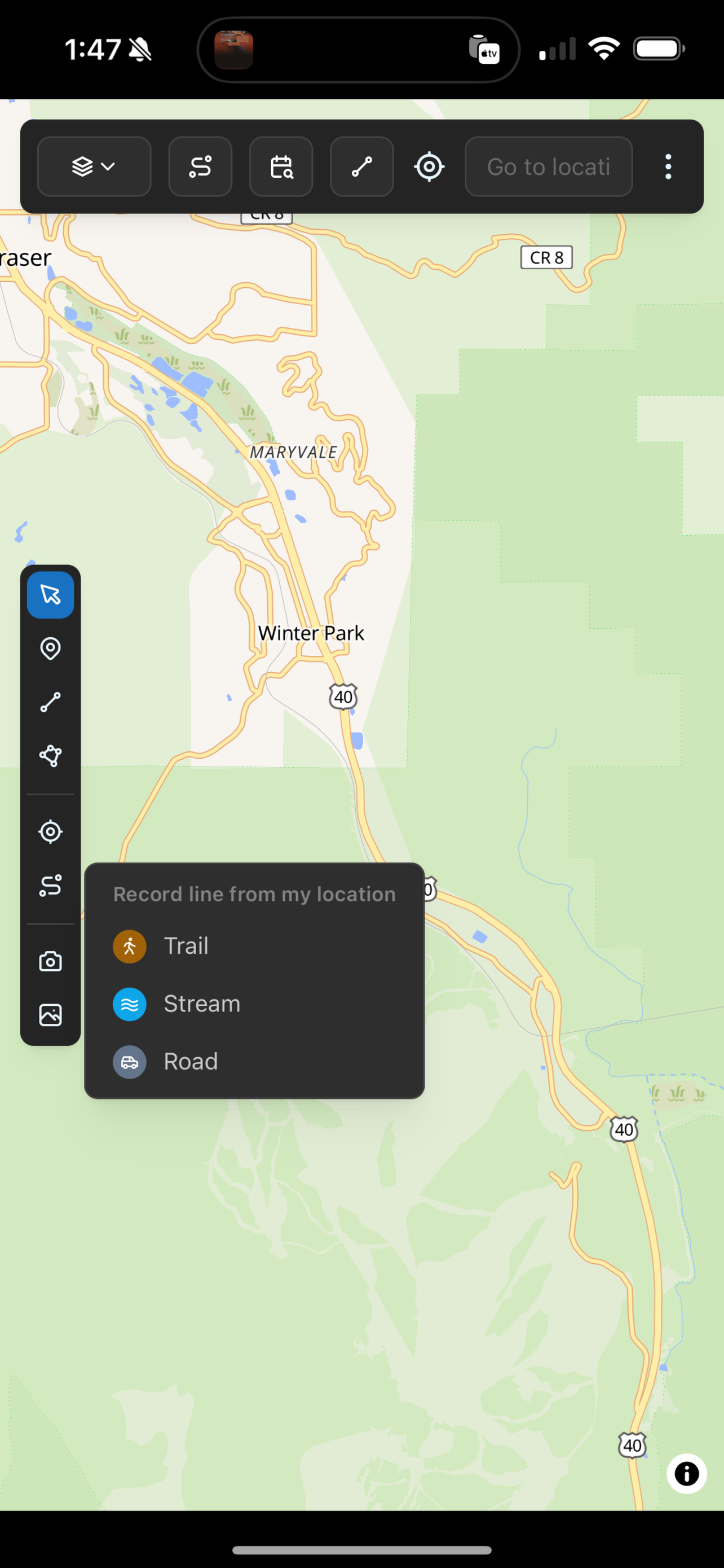
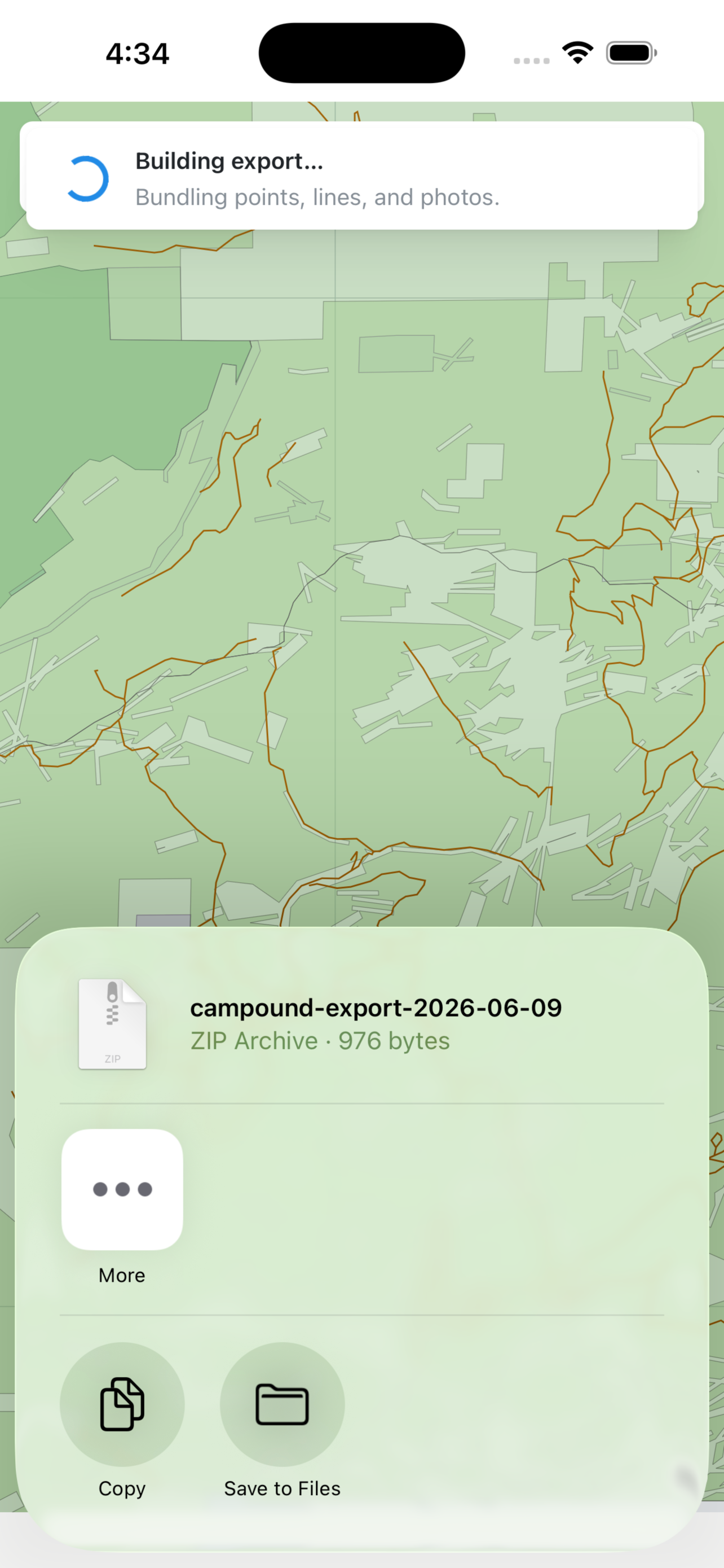
Read the guide →Draw spots and routes with a customizable dictionary of pin types, capture your GPS as you move, and pin geotagged photos. Saved instantly on-device, synced when online. Export the whole library as a single .campound archive — sharable via AirDrop / Mail / Files, openable directly in QGIS, Google Earth, or any GIS tool.
When a hiking partner AirDrops you their .campound, their places, routes, and photos land on your map next to your own — tagged with the bundle name they picked at export, never claimed by your account. A chip row up top toggles each sender on or off; Manage imports in the menu clears a bundle when you're done with it. Found a pin you want to keep? Tap Copy to my data to fork it into your own dataset, edits and sync included.
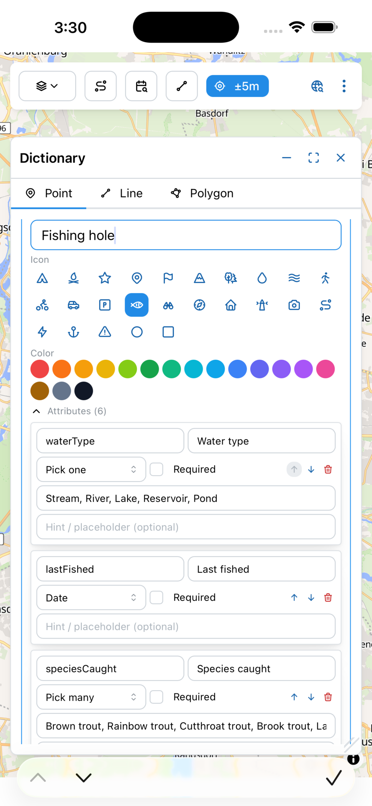
Every pin type can carry a structured form. Drop a Fishing hole and the app asks for water type, species caught, flies that worked, conditions. Drop a Campsite and it asks for site type, water, cell signal, vehicle clearance. The route dialog uses the same schema to show only the fields you filled in. Define your own pin categories — pick-one, pick-many, date, number, yes/no, text — and edit a saved pin any time the form opens pre-filled with what you've already recorded.
Read the guide →When My spots or My routes is on, a draggable legend lists every dictionary type with its swatch + icon. Toggle each independently — scan just your Fishing holes, or just your Campsites — without rerunning a search or losing context. An "Untyped" row covers legacy and GPS-captured pins that don't carry a dictionary type.
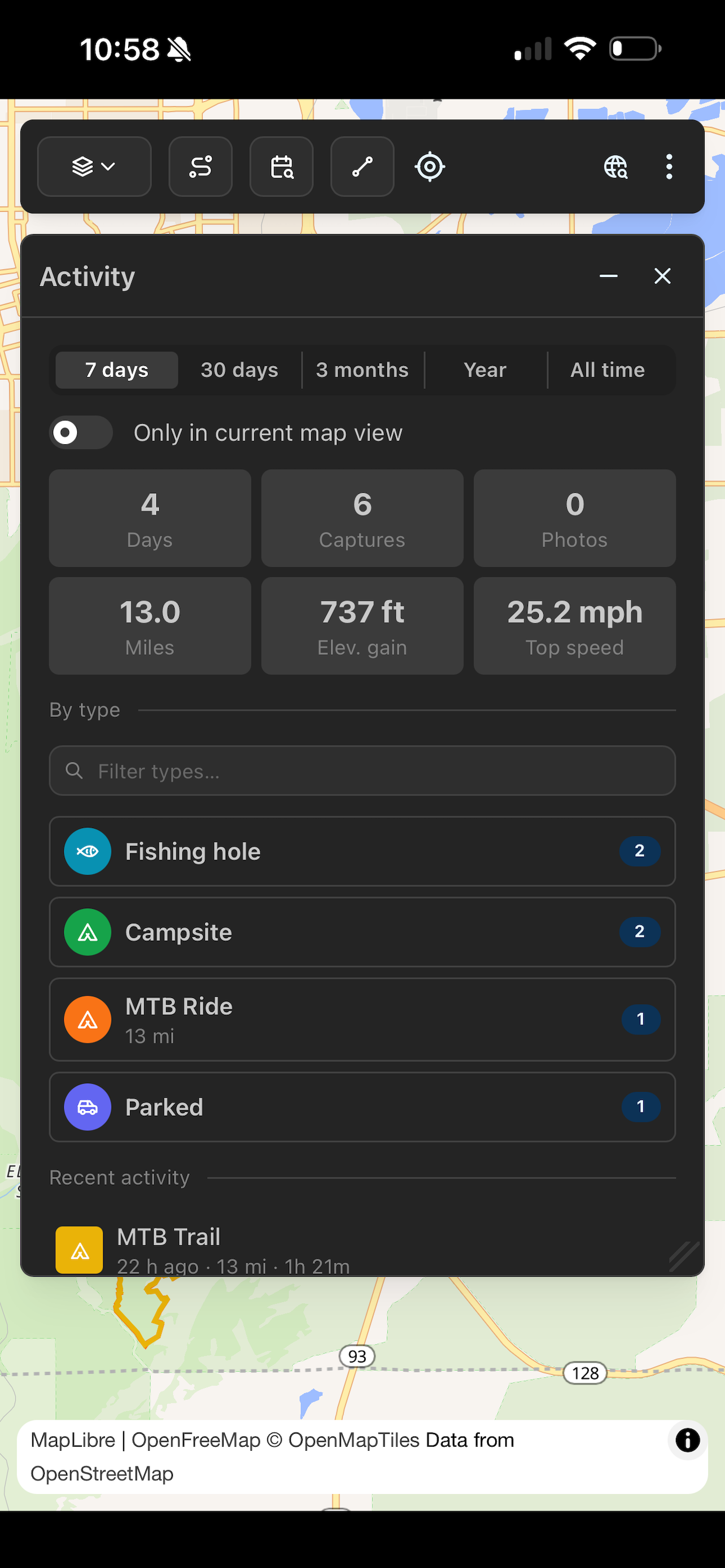
Read the guide →An Activity dashboard rolls up every captured point, line and photo by date range — 7 days, 30 days, 3 months, year, all time. Headline numbers (days active, miles, elevation gained, top speed), a by-type breakdown for each pin category, and a recent feed of your captures. Type-ahead filter by pin name, or restrict the whole view to the current map extent. Tap any item to fly the map there and open the details inline — back-button included.
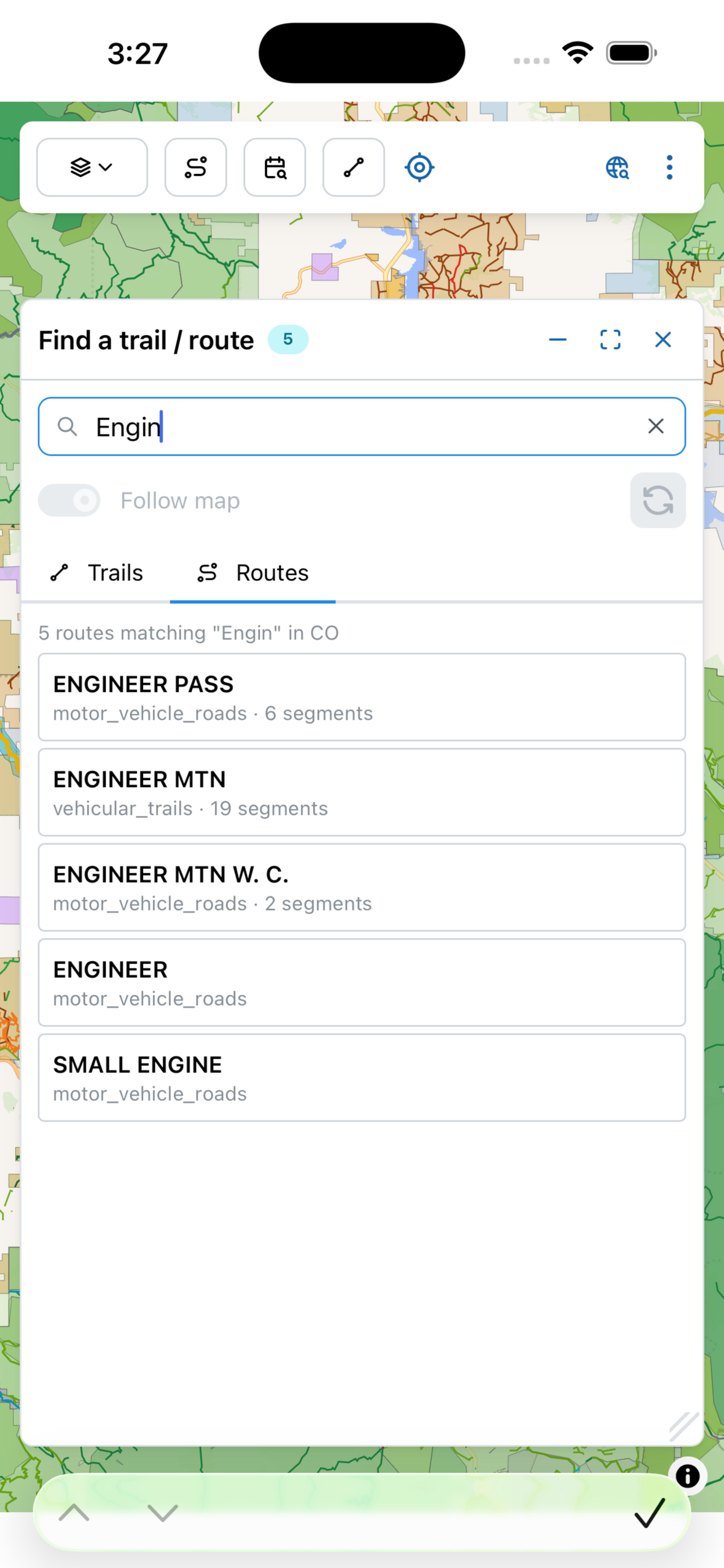
Find-a-trail-or-route now takes any string — "engineer pass", "saxon mountain", "fryingpan" — and finds matches across the entire state, not just the current viewport. Sub-10ms even in California (53,000 unique routes), works offline against a per-state index that downloads alongside the tiles. Results dedupe multi-segment routes into one row and sort by proximity to where you're looking.
Read the guide →Colorado's CPW Gold Medal Streams toggle from the State section of the land legend — every named reach (Fryingpan, Roaring Fork, Gunnison, Animas, South Platte, …) with the designated stretch on tap. Built for anglers; layered alongside trails and roads so you can plan a backcountry hike that ends at a Gold Medal pool.
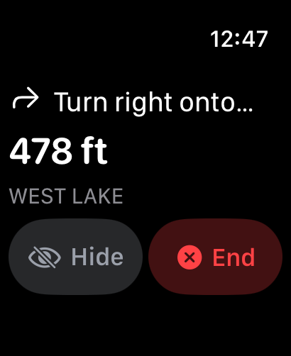
Record waypoints and GPS tracks from your wrist, and — while the iPhone is navigating — see the next maneuver, distance and ETA mirrored to your wrist. Turn-warn haptics are pushed from the phone as discrete WatchConnectivity messages at the exact moment the 400 m threshold crosses — the tap lands the same instant the voice cue does, every time. When the pin type has a notes field, the confirm button becomes Notes… — dictate ("brown trout on a chubby chernobyl, water low"), Done, the text lands on the GeoJSON. A disk-backed outbox guarantees every capture makes it to your phone.
Turn on locate-me and Campound passively detects which trail or route you're walking, riding, or driving. A small "On Continental Divide Trail" badge appears on the map — and on your wrist. Runs natively over the offline trail tiles, so it keeps working with the screen off and barely touches the battery. Ask Siri "what trail am I on?" and the same detector answers, hands-free.
The Multi-trail draw type opens a route builder instead of a freehand pen. Tap the existing trails, forest roads, and your own lines you want to string together — Campound joins the chunks, generates crossing vertices where lines meet at an angle, and shows an inspection panel per chunk. Save it and it lands in My routes with an elevation profile, a flyover, and export — same as any other capture.
Every captured line — a My route, a point-to-point directions result, a saved trail — plays back as a cinematic Mapbox-Outdoors flyover with per-segment pitch and heading. A live HUD shows elevation, grade, distance covered, and pace. Reverse direction mid-flight; the polaroid card that pops in when the camera passes one of your geotagged photos pauses the run so you can re-live the trip visually, not just watch the polyline.
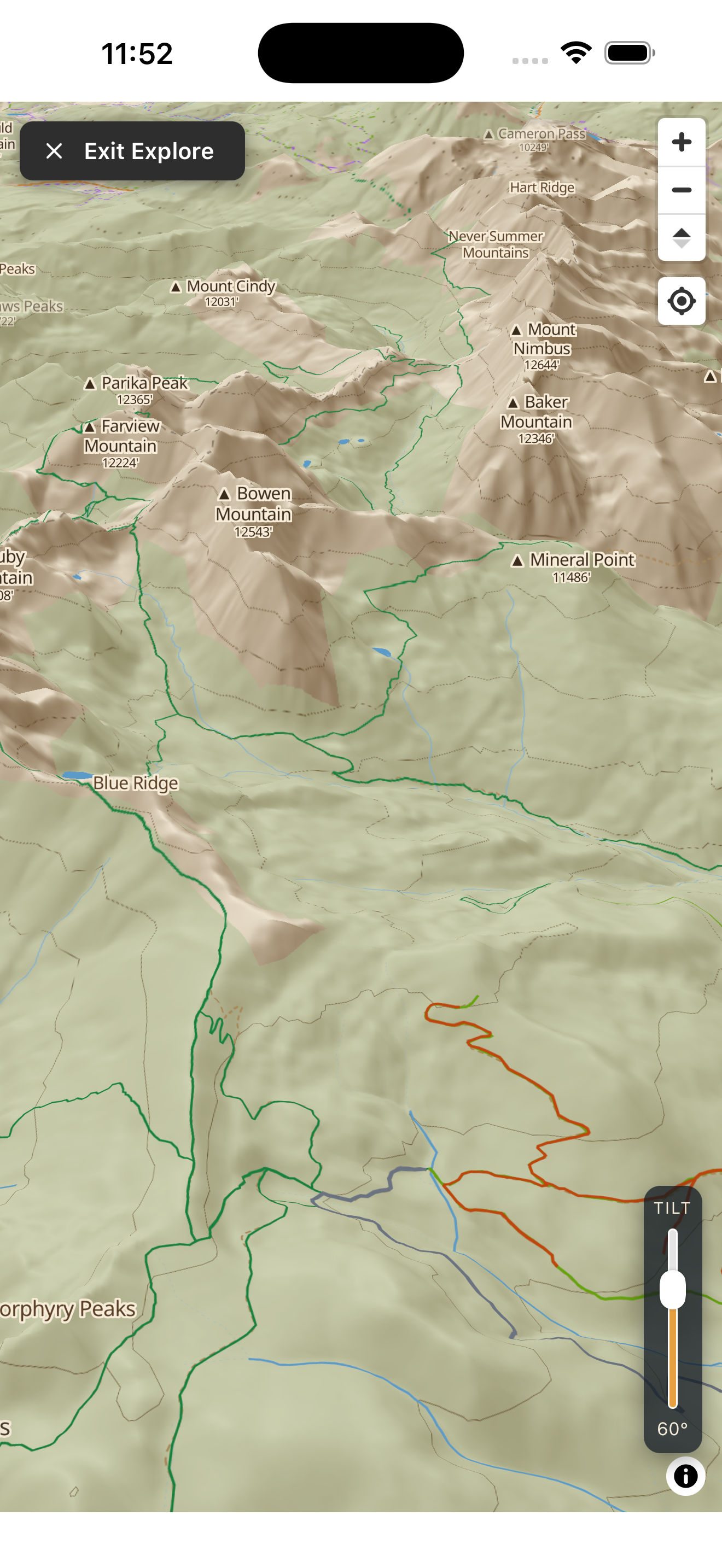
Open Explorer 3D and flip on Peak Sighter. Aim the phone at a distant summit — the 3D map camera swings to match your heading and tilt, then names the peak you're pointing at from the on-device DEM and mountain-peak layer. A ridge-line check keeps a hidden peak from being mis-labeled as one that's actually in front of it. Works offline once the state's 3D terrain tier is installed. No AR camera overlay, no subscription — free, and bundled.
Every dictionary line type declares what kind of workout it is — Hiking, Cycling, Mountain biking, XC skiing, Paddle sports, whatever you record. Toggle Save to Apple Fitness and the completed session persists to HealthKit at stop time: Move-ring credit, workout list entry, and a Show Route polyline drawn from the GPS trace. The "Other" (vehicle) type stays off by default so drives don't spike your Move ring.
Public lands are exactly where cell coverage disappears. Install a state from the in-app Offline dialog and the map, elevation profiles, saved spots, and trail search all run with no connection.
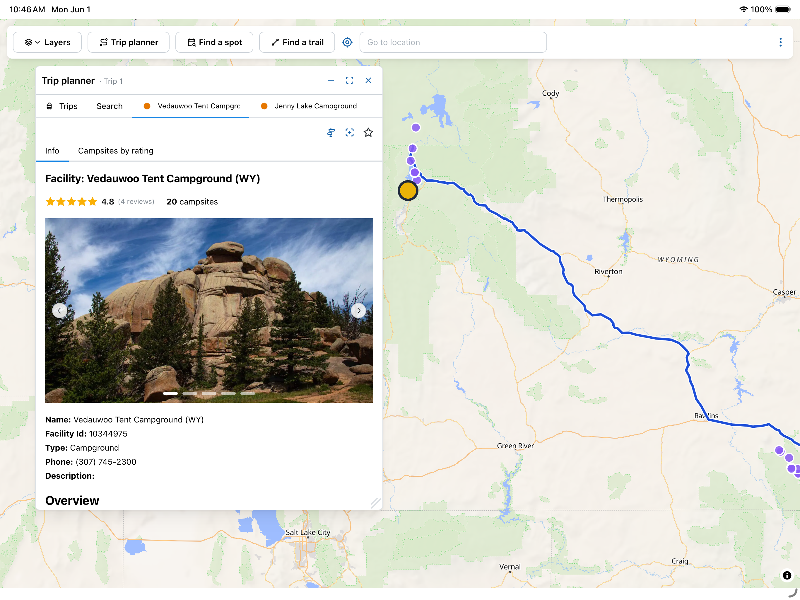
The trip planner, find-a-spot, route detail — all render side-by-side with the map. Stitch a multi-state drive or an off-piste loop together without losing context, and see a campground's photos, ratings, and reservations next to where it sits on the land. It's the same Campound, with room to breathe.
The Apple Watch companion records waypoints and GPS tracks from your wrist — no need to dig out your phone. And while the iPhone is navigating, the watch mirrors the upcoming maneuver, big distance reading, and ETA, with haptics 400 m before each turn, a confirmation tap on completion, and an arrival pattern at the destination. Hide the nav view locally with one tap; the Resume pill brings it back, or End ends the session globally.
Stop refreshing a dozen reservation tabs. Search by date, see what's actually open, and book the night you want.
Color-coded ownership and forest roads make it obvious where dispersed camping is fair game — and where it isn't.
Open the map, follow trails and elevation profiles, and log your route from your watch deep in the backcountry.
One app, the whole workflow — from finding the land to logging the trip.
.campound archives via AirDrop / Mail / Files; tap one to import with Skip / Update dedup, IDs preserved so round-trips are losslessCampound brings together the authoritative public datasets for U.S. lands and recreation into one map you can actually use in the field.
It's free. No subscription, no in-app purchases, no ads, and no account to create. Download it and start exploring.
Yes — open the Offline data dialog inside the app, install any state's tiers, and the map, elevation profiles, saved spots, trail search, and the off-road portion of any navigation route all keep working offline. Coverage is all 50 states. The features that still need a connection are live campground availability (it changes hourly), paved-road routing (Mapbox's network), ratings, and place search — Campound tells you clearly when something needs a signal and re-enables it on reconnect.
Our own basemap — self-hosted vector + terrain tiles built from OpenMapTiles (OSM-derived), USGS 3DEP elevation, USGS NHD hydrography, and USGS place names, styled with a hand-tuned tan-paper palette and per-state 500-ft contours. It ships as three per-state, à-la-carte tiers you install from the Offline dialog: Map data (base vectors), Topo lines (contours), and 3D terrain (DEM, which drives the 3D mesh, hillshade, and offline elevation profiles). No Mapbox dependency for the basemap.
The router is hybrid. On paved roads it uses Mapbox Directions. When the route reaches Forest Service, BLM, or OHV roads — or when there's no paved connection at all — Campound switches to its own A* router that runs on the tiles you've installed. That means the off-road portion works offline. You get voice prompts, ETA, drift-recalc when you wander off the route, and a trail-follow mode when the destination is on a polyline. When the iPhone is navigating, the Apple Watch mirrors the maneuver and distance to your wrist with haptics for each turn.
From the public source of record: Recreation.gov / RIDB for campgrounds, availability and reviews; USGS PAD-US for protected-area boundaries; USFS and BLM for trails, forest roads and routes. Nothing is invented.
Yes — drop waypoints, draw tracks, and attach geotagged photos. They're stored on your device first and sync up when you reconnect. The Apple Watch companion lets you capture them hands-free on the trail. Every campsite, route, or custom point can also be saved to Favorites with an optional 1–5 star rating.
Yes to both. Export bundles every captured point, line, and full-res photo into a single .campound archive and shares it via Mail, AirDrop, or Files. The archive contains points.geojson, lines.geojson, photos.geojson, and a photos/ folder with the original images — GeoJSON is the OGC interchange standard, so the manifests open directly in QGIS, Google Earth, mapbox.com, or any GIS tool.
To import, just tap any .campound file on your iPhone (from an email attachment, an AirDrop, your iCloud Drive, anywhere). Campound opens it, shows you how many points / lines / photos are inside, tells you which ones already exist on your device, and asks Skip or Update. Feature IDs are preserved through the round-trip, so re-imports of the same archive are idempotent — they won't create duplicates. Your data is yours — no proprietary format, no lock-in.
Campound runs natively on iPhone, iPad, and Apple Watch from a single universal app — one download covers all three. The iPad version takes full advantage of the larger canvas: more map at once, side-by-side detail panels, and a layout that's honestly the best way to plan a trip.
Free. No account. Works offline. Download Campound and go find it.
Get it on the App Store