 Campound
The Layers menu
Help guide · Updated June 25, 2026
Open the menu
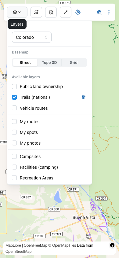
Tap the Layers button at the far left of the toolbar — the stacked-squares icon.
State
Picks which U.S. state's data the app is currently focused on. Trail, route, and land-ownership overlays only load data for the selected state — switching states swaps the entire data set behind the scenes. All 50 states are in the dropdown.
Basemap
There's nothing to pick here — the whole app is drawn on one beautiful basemap, Campound Topo. It's our own cartography, self-hosted (no Mapbox dependency for the map), built from a custom Planetiler profile, USGS 3DEP elevation, and USGS NHD hydrography, styled with a hand-tuned tan-paper palette, hillshade, 500-ft contours, waterways, and place labels. When the 3D terrain tier is installed for a state, the map renders with a live 3D mesh you can pitch and rotate — all on-device, no signal needed.
The only time the map looks different is when you're offline without tiles for the area: a computed coordinate Grid steps in automatically so you keep your bearings, and your Campound Topo map is restored the moment you reconnect or install that state.
The overlay layers
Below the basemap, each row is a separate overlay you can toggle. Five layers have a filter button on the right — the sliders icon — that opens a dedicated panel for narrowing what shows.
Public land ownership
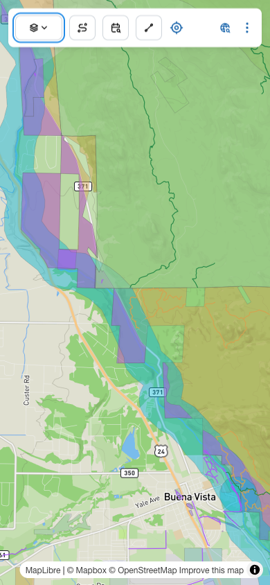
Color-coded polygons for who manages every parcel — National Forest, BLM, National Park, State Park, Wildlife Refuge, Tribal, Private, and many more. Powered by USGS PAD-US. Essential for knowing whether the spot you want to camp is legally open to dispersed camping.
Trails (national)
National Forest trail lines — hiking paths, equestrian, bike, OHV. Filter by who the trail is open to (Hike, Bike, Pack/saddle, ATV…) and by who maintains it (USFS, NPS, State, etc.).
Vehicle routes
Drivable lines — National Forest System roads, BLM roads, and MVUM routes, with surface and passability info. Filter to just dirt roads, just paved, just routes a passenger car can manage, etc.
My routes
Lines you've drawn yourself — trails you traced or recorded with GPS. Filter by Dictionary type to show only your hiking tracks (or only your driving tracks). See Map tools for how to add to this layer.
My spots
Points you've dropped yourself — campsites, trailheads, waypoints, anything. Same filter as My routes, by Dictionary type.
My photos
Your geolocated photos, clustered on the map. Tap a cluster to open the carousel. If you've imported .campound bundles from someone else, a Filter bundles button appears so you can show or hide imports per source.
Campsites
Individual campsites that exist in Recreation.gov's reservation system, pinned on the map. Distinct from Find a spot — that finder queries availability per site; this layer just shows the sites' existence.
Facilities (camping)
Whole campgrounds and other parent facilities from Recreation.gov, drawn as larger markers than individual sites.
Recreation Areas
Top-level recreation areas (National Park, National Forest unit, BLM area) from Recreation.gov, with the area's name and boundary on hover.
The filter panels
Tap the sliders icon next to an enabled layer (it only appears when the layer is on) to open that layer's filter panel. Each panel floats over the map — it stays put while you pan or zoom, and you can minimize it to a header pill or close it entirely. The reset arrow at the top right of each panel restores the layer's defaults.
Trails filter
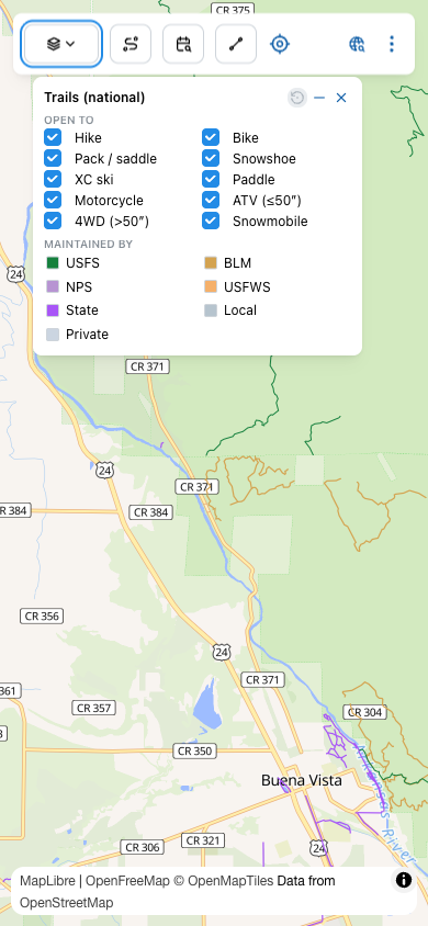
Useful for narrowing the trail clutter to just what matters to you — uncheck Motorcycle, ATV, 4WD, and Snowmobile to see just non-motorized trails; uncheck everything but Hike to see just walkable paths.
Land ownership filter
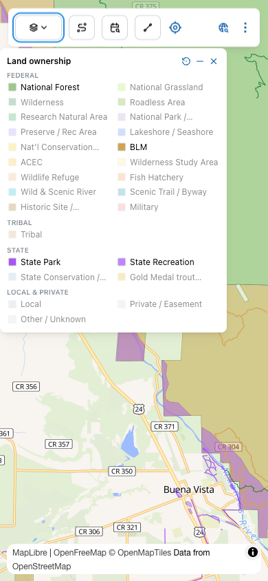
Click a row to toggle that category. The color swatch is the same one painted on the map, so the legend doubles as a key — if you see purple polygons on the map, find the purple swatch in the filter to see what it is.
Vehicle routes filter
Same shape as Trails: OPEN TO (motorcycle, ATV, 4WD, passenger car, etc.) and SURFACE (paved, dirt, gravel). Useful for filtering down to "roads my Subaru can handle" or "everything I could ride on my dirt bike."
My routes / My spots filter
Filters by Dictionary type. If you have a hundred saved points but only want to see your "Fishing hole" points right now, this is where you turn the others off without losing them.
My photos — bundle filter
This filter only appears when you've imported .campound bundles from someone else. It lists each bundle separately so you can show or hide an entire import at once — useful when a friend sent over a trip's worth of photos and you want to scope the map to just yours, or just theirs.
Tips
Offline data→
How to pre-download map tiles, trail and route data for a state before you lose signal — and how to manage what's cached.