 Campound
Map tools
Help guide · Updated June 25, 2026
Turn it on
Open the More menu (three-dot icon, top-right of the toolbar) and flip the Map tools switch on. The toolbar appears along the left edge of the map and stays there until you turn it off.
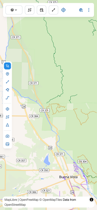
The toolbar at a glance
Top to bottom, the icons divide into four groups.
| Group | Tools |
|---|---|
| Select | Select / edit — the default mode. Tap features to open their detail; drag to reposition. |
| Draw | Draw point, Draw line, Draw polygon, Directions. |
| GPS | GPS point (capture at current location), GPS line (record a trail or route as you walk, ride, or drive it), Directions from my location. |
| Photo | Take photo (camera), Add photo from library. |
The drawing tools
Tapping a draw tool opens a small menu of the matching Dictionary types — points show point types, lines show line types, polygons show polygon types. Pick a type to enter draw mode for that type.
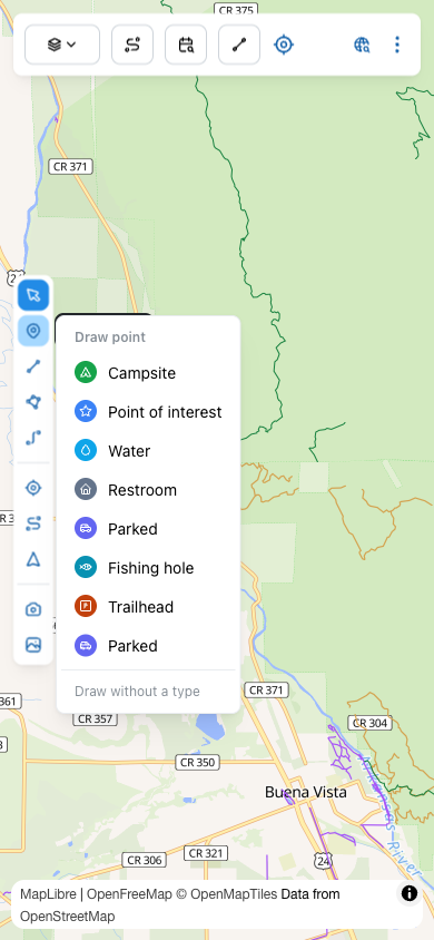
Once you pick a type, the toolbar icon for that tool changes color to match the type — a visual reminder that you're in draw mode and what you're dropping.
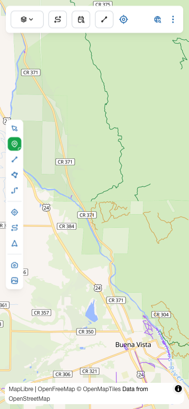
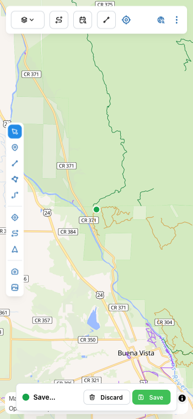
Tap on the map to drop. A confirmation bar appears at the bottom with Discard and Save.
Drawing trails, routes, and areas
The line and polygon tools work the same way as Draw point — pick a type, then tap on the map.
- Draw line — for tracing a trail or route by hand. Tap to add vertices along the path, double-tap to finish. The line draws in the type's color. Use this when you've already moved through the area (or planned it on the map) and want to lay the path down explicitly.
- Draw polygon — for an area. Tap to add vertices, tap the first vertex (or double-tap) to close the shape. Polygon fills with the type's color at reduced opacity.
Directions
The Directions tool in this group is for plotting a route between two map points you'll choose (a start and a destination), as opposed to Directions from my location further down, which uses your current GPS fix as the start.
The GPS tools
This group uses your phone's GPS instead of map taps.
GPS point
Captures a point feature at your exact current location, no tapping required. Tap the tool, pick a type from the menu, done. Useful for marking exactly where you are right now — a hard-to-describe trail junction, a downed tree, the trailhead sign.
GPS line — record a trail or route as you go
This is the tool for capturing a trail or route by actually walking, riding, or driving it. Tap the icon, pick a line type (Trail, Road, MTB Ride, Stream, whatever you've defined), and the app starts logging GPS fixes into a line behind you. Keep moving — the line grows in real time. Tap the icon again (now showing in your type's color) to stop and save.
This is how you build up your own trail and route library: hike a path nobody's mapped, drive a forest road that isn't in the published data, paddle a river — they all save the same way and become layers you can navigate to later.
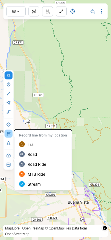
Directions from my location
Like Directions, but pre-fills your current GPS fix as the start. Tap, then tap a destination on the map.
The photo tools
Photos are geolocated and become their own layer on the map.
- Take photo — opens the camera. The photo is tagged with your current location.
- Add photo from library — pulls a photo you already have. If it has GPS EXIF, that's used; otherwise the photo lands at the center of the current map view.
Both go through the system file picker so the app doesn't need full Photo Library access — only what you explicitly select.
Tips
Capture a photo→
A closer look at the photo flow — how thumbnails get clustered on the map, how the carousel works, and what happens to full-resolution originals on disk.