 Campound
Offline data
Help guide · Updated June 25, 2026
Open Offline data
Open the More menu (three-dot icon, top-right of the toolbar) and tap Offline data.
If any of your downloaded states have updates waiting (the catalog has been refreshed with new trail data or fresh tiles), you'll see a small yellow dot on the menu item — that's your cue to come in and refresh.
Storage usage
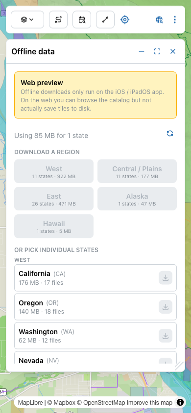
The line above the region grid reads Using N MB for X states — that's the total disk footprint of everything currently downloaded. The refresh icon next to it forces a re-check of the catalog for new versions.
Download a whole region
For trip planning at scale, pick a region:
| Region | What's in it |
|---|---|
| West | 11 states (~922 MB) — California, Oregon, Washington, Idaho, Montana, Wyoming, Colorado, Nevada, Utah, Arizona, New Mexico. |
| Central / Plains | 11 states (~177 MB) — North Dakota down through Texas. |
| East | 26 states (~471 MB) — everything east of the Mississippi. |
| Alaska | ~47 MB. |
| Hawaii | ~5 MB. |
Sizes vary by region because western states have far more federal trail and forest-road data than eastern ones. Tap a region to queue every state inside it for download — the app fetches them in sequence and updates the badges as each finishes.
Or pick individual states
Below the region cards, every state is listed individually, grouped by region (WEST, CENTRAL / PLAINS, EAST, ALASKA, HAWAII). Each row shows the state name, its abbreviation, total download size, and the number of files in the bundle. The download button on the right starts the download — or shows a status pill if the state is already on disk.
The status pills
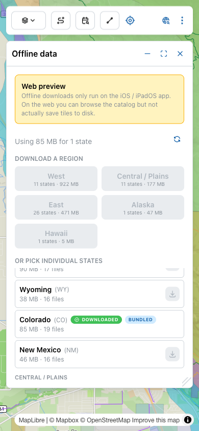
The combination matters because Bundled data is frozen at app-release time. Downloaded data is always the latest version in the catalog. If a state shows both pills, you're running the freshest copy; if it shows only Bundled, the app catalog may have a newer version waiting (the yellow dot on the More menu hints at this).
What's actually in a download
Each per-state bundle contains:
- PMTiles archives for the Campound Topo basemap — the base vectors, the 500-ft contour lines, and the relief-shaded 3D terrain, each an independently-installable tier sliced to that state's bounding box. These are what make the map render with no signal.
- Trail vector data — the National Forest trails, MVUM routes, and any other line datasets used by the overlay layers.
- Land-ownership polygons — every PAD-US parcel for the state, with its agency and category attached.
Things not included: Recreation.gov campsite availability (live, needs signal), Mapbox driving directions (Mapbox API, needs signal), and the cinematic flyover / Explorer 3D view (rendered from Mapbox Outdoors, needs signal — the offline-bundled Campound Topo is a different, self-hosted style).